
Despite worldwide renown as a centre of bushfire research and digital innovation, NSW appears to be failing to effectively apply its data wellspring to dampen the bushfire threat, with a recent inquiry finding a lack of consolidation of data resources has hampered the Rural Fire Service’s real-time mapping and tracking capability.
The inquiry, commissioned by the NSW Government, proposed 76 recommendations to “plan and prepare” resources for future bushfire fights, with certain “operational and process” changes expected to be actioned immediately in the lead up to the next bushfire season. Research and strategic policy frameworks changes would, the report noted, require a longer-term implementation timeline.
The Government said it would accept every recommendation “in principle”, with implementation to be overseen by Resilience NSW, the state’s chief disaster management agency.
Among the recommendations include a number of advanced ‘fire mapping’ technologies to aid front-line efforts, including drones, artificial intelligence (AI), remote sensors, as well as better application of data and “fire science” to track and target bushfire spread across the state.
While the inquiry found that technological advancements and recent research had, to date, provided backend staff and on-the-ground responders a greater understanding of, and capacity to fight bushfires, it stressed an urgent need to go further.
State authorities were advised to push “our technological and our research capabilities much harder” to improve fire risk interpretation and response.
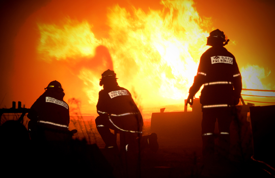
Emphasising the increasing risk posed to front-line firefighters today – with tragically nine firefighters perishing in the line of duty last bushfire season – the inquiry implored the Government to fund the rollout of unmanned aircraft and vehicles “to their fullest capacity” to minimise risks to first responders and indeed all firefighting personnel.
Internet of things (IoT), or remote sensor technologies, were singled out as a critical investment priority for state firefighting forces, offering, the report said, an “invaluable aid” to front-line responders.
Data collected from sensors – typically mounted on firefighting infrastructure, including vehicles and unmanned drones – as well as from satellites, can assist firefighters not only in sighting immediate, on-the-ground threats, such as the location, extent, and behaviour of fires, but also longer-term predictions of weather patterns and climate shifts that can radically impact bushfire behaviour.
While it did note the NSW Rural Fire Service’s (RFS) use of remote sensors over the last 20 fire seasons, the inquiry stressed that, given recent advances in the technology, they were “not used as extensively as [they] could have been”.
Gathered correctly, spatial data can offer an invaluable ‘read’ of real-time conditions, giving ground crews a clearer understanding of the extent and behaviour of bushfires.
Indeed, recent innovations in remote sensing systems could provide immediate safety benefits for front-line RFS crews, it said, giving precise fire threat readings even through heavy smoke, cloud, fog and dust.
The inquiry also advised the Government to establish a ‘spatial technology acceleration program’, that could “maximise information available from the various remote sensing technologies currently in use”.
Building a ‘national picture’
While NSW is said to be among the leaders in the adoption of bushfire-fighting tech, the RFS appears to be let down by the lack of a consolidated data resources, as well as an inadequate national system to chart the spread of fires.
While state departments appear to be well provisioned with remote sensing technologies, the inquiry found sensory and image data is not being adequately consolidated with related datasets gathered from other government departments (including Federal agencies, such as the Department of Defence), limiting the RFS crews’ ability to track increasing massive fire fronts.
Data from these multiple systems was not being aggregated and assessed in a way that could effectively track immediate fire threats and predict their likely spread.
There is, the report noted, “no single remote sensing source that can give the complete picture of a fire at once, [and no way to fuse] data from multiple remote sensing and other sources”.
Combining datasets from remote sensing technologies in the field not only helps to build an accurate, real-time visualisation of bushfire threats – allowing ground crews to determine a fire’s edge, speed of change, temperature and potential spread – but can also spare reconnaissance crews from front-line engagements.
Such remote sensing data would have proved invaluable during the 2019-20 fire season, where fires were considered so large and smoke so dense that it often deemed too hazardous for manned aircraft to make necessary ‘line scanner’ readings from the fire front, the report found.
Enhanced capabilities for remote sensing data would also allow for “early detection of new ignitions, real-time tracking of the fire edge progression and intensity as it spreads, and [a] better understanding of vegetation and fuel load issues before the fires start”.
Early detection, particularly in similar weather conditions as those experienced last bushfire season, could prove critical for early-stage fire suppression, preventing smaller fires from mutating into uncontrollable ‘megafires’.
Artificial intelligence can also help in fire path prediction and visualisation. Specifically, image processing techniques can help piece together a continuous picture of bushfires and predict specific threats to communities.
In order to effectively consolidate and deliver life-saving bushfire detection data, the report recommended the development of “comprehensive data platforms and decision-making tools”, with the government advised specifically to implement a “single whole-of-government procurement and acquisition program for imagery and LiDAR [Light Detection and Ranging scanning]”.
Drone technology improvements
Significant improvements can also be made in the area of remotely piloted aerial systems (RPAS), which, across 50 reconnaissance missions last season, provided crucial intel to the RFS.
Fire and Rescue NSW currently has 15 drones on hand equipped with varying sensory capabilities, from “high-resolution visual cameras to specialised infrared sensors”.
The inquiry recommended expanding FRNSW’s drone capability, boosting both equipment and trained operator numbers.
Doing so, it was argued, would not only improve situational awareness for ground crews and mitigate risks to manned aircraft personnel, but also deliver a strong return on investment.
Indeed, analysis of the California wildfires revealed that drone technology provided both significant ROI and represented a much lower cost per use than manned reconnaissance helicopters or planes.
Drones, the report noted, are versatile, low-cost and, unlike manned aircraft, can be flown day and night with ease to accomplish a range of mission goals.
Negotiating better rules around drone-flying ‘safe zones’ could also reduce some the hurdles that prevented their rapid deployment during last firefighting season. This includes revising airspace restrictions around commercial and recreational aircraft, as well as in expediting the sharing of drones between government agencies.
The systems used to capture, display, and share drone visual imagery and data are also in need of urgent revision, the report said.
While the RFS can display and assess drone imagery, there is still no single function able to “fuse” image and sensor data collected by multiple input sources – including data gathered by Defence, Forestry Corporation of NAQ (FCNSW) Map App, and Fire and Rescue NSW (FRNSW) drones – that could give the RFS or other emergency services personnel a more complete picture of bushfire threats.
This ‘missing link’ system would have immeasurable value for the RFS, allowing it to make informed decisions on resource allocation, threat response, and in the issuing of more accurate fire threat warnings to the public.
Embracing tech in the future fire fight
The 2019-20 season was unprecedented in its ferocity and devastation.
More than 17 million hectares of land across Australian was ravaged by fire last summer – an area larger than the England and Wales combined.
NSW was among the worst-hit states, with bushfires spreading across more than five million hectares (nearly seven per cent of the state) and destroying more than 2,400 homes.
This also included significant damage to the natural environment, with more than 80 per cent of the World Heritage listed Greater Blue Mountains Area and 54 per cent of the NSW components of the Gondwana Rainforests of Australia World Heritage area affected by fire, according to the NSW Department of Planning, Industry and Environment.
As Australians brace for what will likely be ever-more pervasive and destructive bushfire seasons ahead, the importance of implementing the latest firefighting technologies has become increasingly pressing.
By further developing and adopting firefighting technologies, NSW will not only be in a better position to mitigate the human and environmental cost of bushfires, but also position itself as a leader in bushfire research, innovation, technology advancement, and training, the inquiry said.
NSW Premier Gladys Berejiklian said the Government has been working with the RFS and Resilience NSW, to ensure the state is “as prepared as it can be” for the upcoming fire season.
However, Berejiklian acknowledged that governance and responsibility needed to be further addressed to improve bushfire management.
Deputy Premier John Barilaro added that all 76 recommendations of the inquiry are based on lessons learnt from last season’s devastating bushfires.
“Last bushfire season was unlike anything we have ever dealt with before and we need a government response to match,” he said.
The NSW Government announced more than $45 million in additional funding earlier this year for fire hazard reduction and in upgrades to firefighting capability.
However, with the summer bushfire season rapidly approaching, considerably more work will need to be done to ensure that the recommendations, particularly in the deployment of bushfire tracking and prediction technologies, can be implemented before on-the-ground resources become overextended.